
ikfoundation.org
The IK Foundation
Promoting Natural & Cultural History
Since 1988
- WELCOME
- THE IK WORKSHOP SOCIETY
- THE FIELD STATION LAB
- THE DONATION ROOM
- BOOKS & ART0


- CONTACT
iFellows Sign In
Find out more about becoming an iFellow...My Basket
Items: 0Total: €0.00
A Bird’s-eye view
Since ancient times, people and animals have been curious to reach higher locations in their landscape, from a block to a hill or a mountain, to gain an overview and see the context! In the 19th century, hot air balloonists were accompanied by artists in the gondola to visualise what they saw. When the process of depicting the landscape on a photographic plate developed, documentation from a bird's-eye view became more accurate for the first time.
In the early 20th century, aerial photography was primarily used for military reconnaissance and mapping, which evolved in pace with aeroplanes' technical capabilities. In 1923, the English archaeologist and pilot Osbert G. S. Crawford lectured at the Royal Geographical Society at Kensington Gore in London. This was the first occasion that aerial photographs featuring images of Stonehenge featuring an archaeological connection were displayed; since then, Crawford has been regarded as the father of aerial photography.
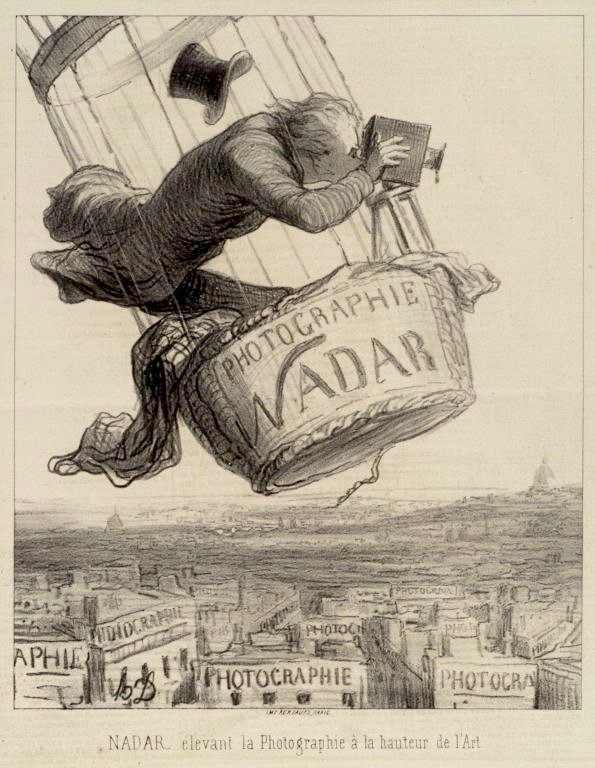
Nadar elevating photography to Art. Published in Le Boulevard, May 25, 1862. By Honoré Daumier. Photo: Brooklyn Museum.
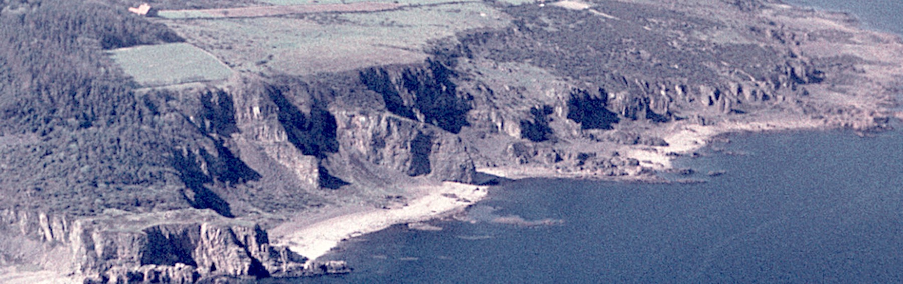
Interpreting aerial photographs is a multidisciplinary effort, as illustrated by the examples above. This work has occurred primarily in North America and select European countries, where there has been a long-standing commitment to systematically developing archives and knowledge regarding the use of aerial photography across various scientific fields.
However, the revolutionary possibilities during the recent decade, with cameras affordable enough to be used in the air by more than just specialist organisations, could hardly have been foreseen 25 to 30 years ago. The same applies to all increased digitalisation, which includes not only drones but also satellite images, digital maps, and many other digital projects, many of which are free for everyone to use on the Internet. While all new technology and the growing interest in viewing the world from a bird's eye perspective digitally have had many positive effects, the availability of older references to aerial photographs has, to some extent, been lost. The ability to interpret such images through different methodologies or possess the technical photographic expertise to process the pictures correctly for exposure, filtration, and so on are rare skills today. A century of development and knowledge may partly be lost in the ever-accelerating pace of new digital technology! Despite all these new tools, old pictures still hold great value for research and understanding of natural and cultural history.
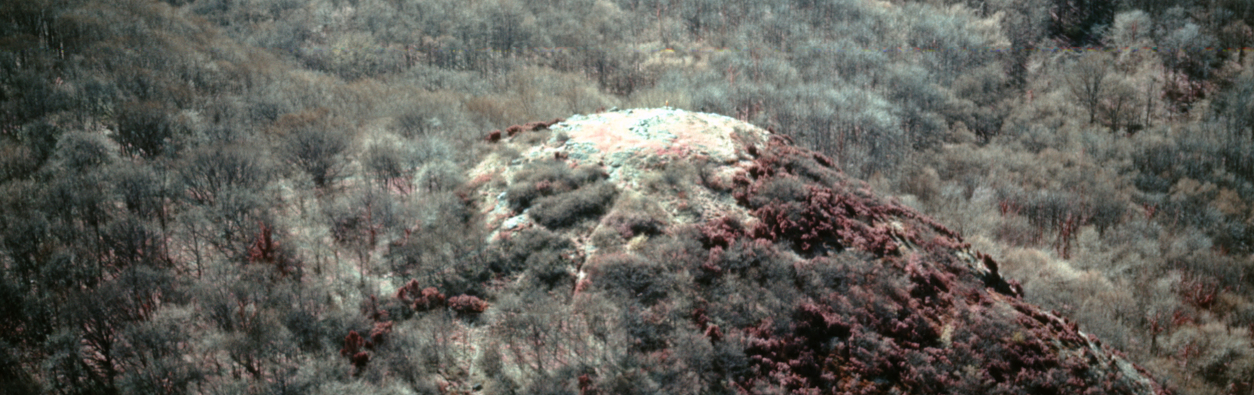
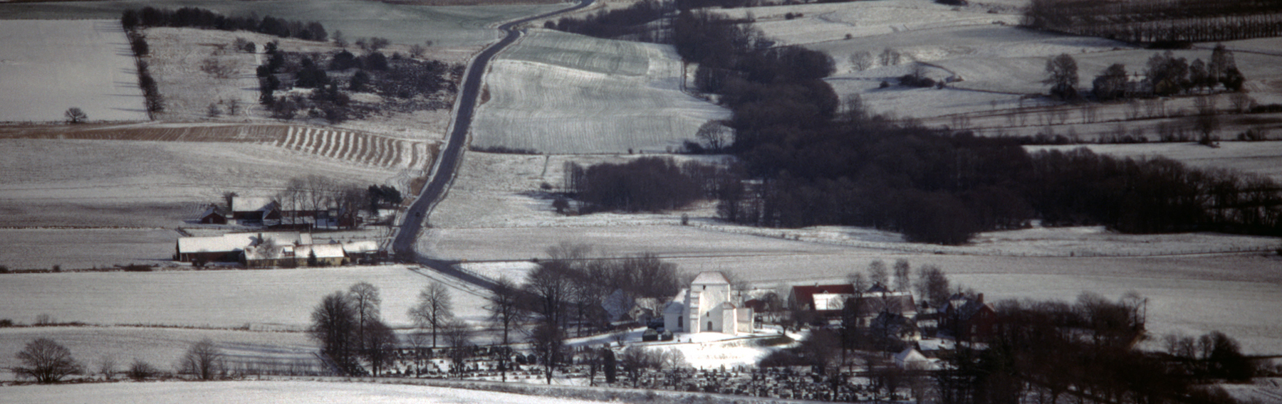
The Aerial Picture Series at The IK Foundation
In the autumn of 1992, IK published the book Flygspaning efter Historia [Looking at History from the Air], which is based on the first long-term documentation of a geographical district and its landscape from multiple perspectives. Specifically, it utilises the major archaeologist Esse Ericsson’s aerial photographs, taken over three decades during the 20th century, with a particular focus on the southernmost provinces of Sweden.
Esse Ericsson’s work was well-known. He collaborated with leading Swedish archaeologists such as Professor Holger Arbman and Dr. Gad Rausing and engaged with museums and folklore societies in the provinces. Ericsson’s pioneering work combined his multidisciplinary approach with technical expertise, garnering international attention, including from the renowned Committee for Aerial Photography at Cambridge University in England.
In 1988, Esse donated his entire collection of aerial photographs, accompanying notes, and a library to The IK Foundation, ensuring they would be preserved for public access in the future. Over several years, an extensive provenance search and cataloguing of thousands of images took place, culminating in the publication of the aforementioned book in 1992.
In addition to the archive from Esse Ericsson, IK also maintains a more recent aerial photographic archive, developed in the 1990s through collaboration among naturalist Lars Hansen, pilot Gudmund Ahlberg, and archaeology professor Johan Callmer. This effort involved the development of new photographic techniques, supported by the Erna & Victor Hasselblad Foundation. Consequently, IK houses two distinctive and extensive collections of aerial photographs, with the oldest dating back to the 1930s and the most recent extending into the early 21st century. IK also possesses smaller photographic collections from various global regions, which continue to expand through ongoing fieldwork.
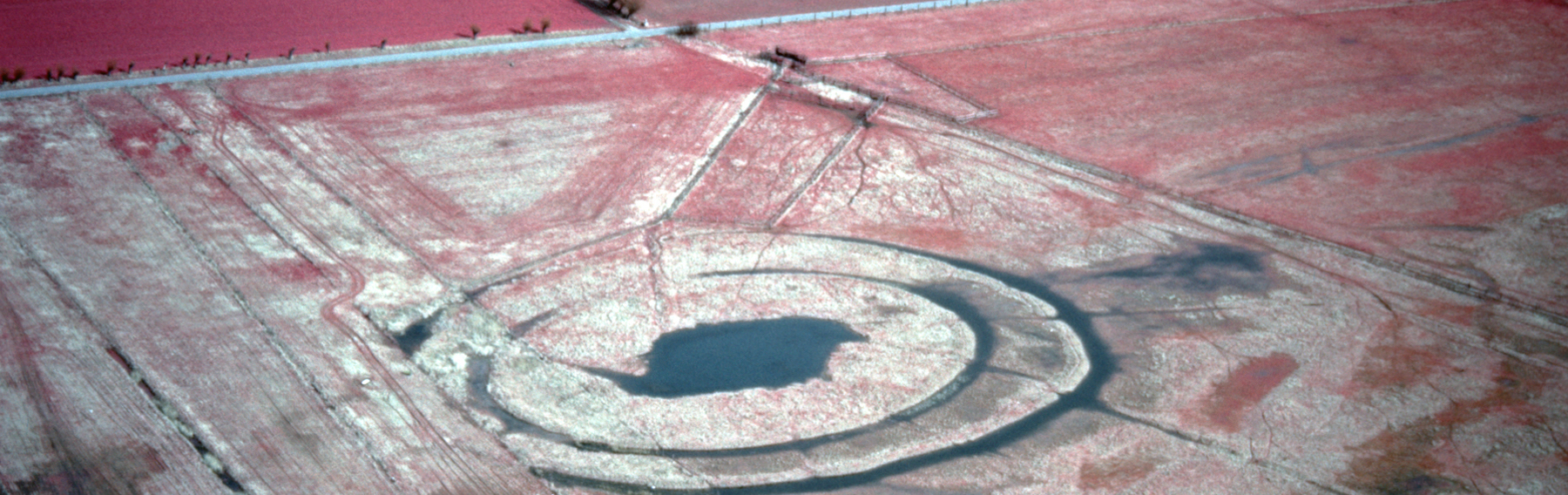
A local and global reference work
In 1838, court marshal R H Stiernsvärd wrote: ”To Sweden is attached a small piece of land named Skåne, to show Sweden what the rest of Europe looks like.” This observation is correct and interesting, as this southern Scandinavian province contains diverse environmental ecosystems, found in many other northern hemisphere regions – a so-called reference landscape type.
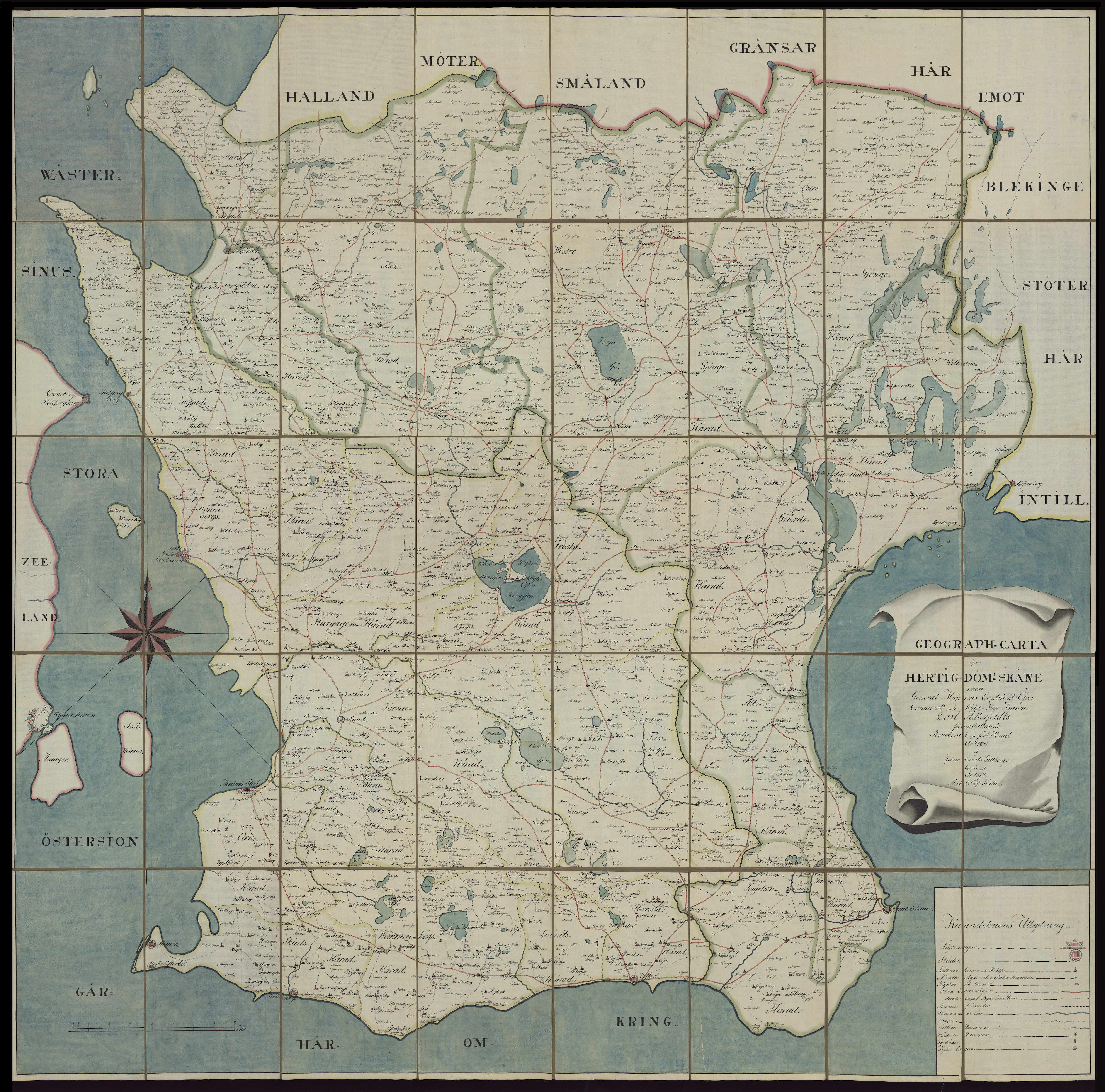
This detailed map of the southernmost Swedish province Skåne – a geographical area with a rich natural and cultural history variation – had been improved by the surveyor Johan Lorens Gillberg in 1766 and copied by And. Christ. Hahr in 1812. (Courtesy of: Uppsala University Library, Sweden. Alvin-record:98362. Public Domain).
This environmental diversity makes the aerial picture archive at IK internationally significant. It serves as a reference for interpreting aerial photographs across varied landscapes. The archive is a unique source of nature, culture, and environmental history, useful for sciences and local interests, and reveals information about vanished and changed landscapes.
The enterprise
In March 2021, The IK Foundation contributed physical archival materials – including writings, maps, notes, and research papers – to the Swedish National Archives, one of the oldest public authorities in Sweden, founded in 1618. Since becoming an independent authority in 1878, the National Archives manages both public and specific private archives, focusing on preserving national heritage. This donation signifies a fresh start for the materials, guaranteeing their long-term care and availability. A digital version, featuring thousands of images, is accessible on the iBirdsEye website to promote knowledge and technological progress in the Natural & Cultural History of various landscapes. The Thora Ohlssons Foundation in Sweden supported the preparatory work for this donation.


The IK Foundation & Company Promoting Natural & Cultural History
|
Subscribe to our Newsletter | IK Global iMessenger |
Translate Page |


|
© The IK Foundation & Company 2026 - a truly European organisation since 1988 |
The IK
Workshop Society
Workshop Society
The Field
Station Lab
Station Lab
How to cite & Creative Commons
You are welcome to use the information and knowledge from
The IK Workshop Society, as long as you follow a few simple rules.
LEARN MORE & I AGREE
You are welcome to use the information and knowledge from
The IK Workshop Society, as long as you follow a few simple rules.
LEARN MORE & I AGREE
